 Population299,273 (2025)
River Towns Keep Foothill Traditions Moving Forward
Cherokee County, GeorgiaHistoric Canton, lively Woodstock and the Etowah River create different starting points for exploring Cherokee County. Its communities bring together local history, downtown activity and outdoor recreation in the north Georgia foothills. Ball Ground, Holly Springs and Waleska add more places to discover beyond the county’s largest centers. Choose a history stop or a town to explore, then build your day around nearby attractions and official local information for services, access and current events.
Cherokee County at a Glance
Population299,273 (2025) County SeatCanton
 Largest CityWoodstock
 Established1831
 Total Area434.2 sq mi (land and water)
 Key RoutesI-575 · GA 20 · GA 92
Discover the County
Cherokee County
Cherokee County was established in 1831, with Canton serving as its county seat. The county’s history is inseparable from the Cherokee people and the changes that followed European American settlement. Local historical interpretation offers a more complete account than a brief roadside introduction can provide. Canton, Woodstock and the smaller communities developed distinct identities over time. Today, the Etowah River, historic downtown settings and institutions such as the Cherokee History Center provide useful ways to connect the past with the county’s present character.
Use downtown Canton or Woodstock as a starting point, then leave space for another community on the itinerary. The Cherokee History Center offers a focused heritage visit, while official tourism information can help identify current attractions, restaurants and shops. Outdoor plans should account for trail conditions, weather and any posted rules. Residents and prospective residents can begin practical research with the county government, school district and library system rather than relying on older directory entries.
What Shapes Us
Local Heritage
The Cherokee History Center in Canton provides context for the county’s people and communities, including the Cherokee history behind its name.
Landscape and Place
The Etowah River, Canton and Woodstock anchor different kinds of outings. Ball Ground, Holly Springs and Waleska add more communities to explore.
Community Connections
Connect a downtown visit with the county’s parks, schools and library resources. Canton and Woodstock are useful starting points for discovering local services.
River towns and foothill stories connect our shared future.
My Local Guide
Cherokee County
County Places & Landmarks
County Resources
Local Resources, Connected
Use official resources to connect with local services. Confirm service areas and current requirements directly with the provider.
Government
Cherokee County Board of Commissioners
Schools
These are selected school links, not a complete school directory. Use the district website for its full school list, attendance boundaries, enrollment documents and current calendars. Confirm which school serves your address before registering.
FAQ: Reopening Canton Elementary School
FAQ: The New Cherokee High School
Hospitals
Call 911 for emergencies. Use the hospital website for departments, locations and visitor information.
Public Safety
Emergency Services
Parks & Outdoor Recreation
Use the managing agency’s current notices for hours, fees and access. Regional visitor directories may include nearby places outside the county.
Trails & Walking
Check the linked park or recreation directory for trail maps, walking facilities and current closures before your visit.
Utilities
Cherokee County Water and Sewerage Authority customer service: 770-479-1813, 140 West Main Street, Canton. Ask about address eligibility, account setup, deposits and connection requirements.
Electric service
Confirm the supplier for your exact address before applying. Start with the existing bill, landlord or seller; county boundaries alone do not identify the provider. Georgia EMC’s cooperative directory provides member utility contacts. If the address is served by Georgia Power, use its start, stop or transfer service page. Ask the confirmed supplier about deposits, connection dates and outage reporting.
Libraries
Courts
DMV
Find a Georgia DDS service center
New driver license, ID or permit
Transportation
When arranging a ride, provide your pickup address, destination and required arrival time. Confirm the return pickup, total fare, advance-booking deadline and any mobility assistance with the transit provider. Road maintenance offices do not make passenger reservations.
Postal Services
Veterans
Find a Georgia veterans field service office
Veterans benefits claims assistance
Veteran driver license information
Employment
Cherokee school district employment
Find a Georgia Department of Labor career center
WorkSource Georgia job and career portal
We’re Here to Help
Useful information for exploring the county and settling in.
Helpful Information
Frequently Asked Questions
Start here for county background, visitor planning and official local information.
Cherokee History Center is a signature destination. Check its official information for access, hours and any admission or reservation requirements.
Its identity includes Etowah River recreation, historic Canton and lively Woodstock. Official visitor information can help you build an itinerary around the places that interest you.
Cherokee County was established in 1831. New Georgia Encyclopedia provides historical context.
Canton is the county seat. Cherokee County Government is the starting point for county services and official notices.
Woodstock is the largest municipality by population. The county seat is Canton.
Georgia’s Department of Community Affairs lists 299,273 people for 2025. 2025 Georgia County Populations is the source used for this guide.
Start with Cherokee History Center for current visitor instructions. Confirm the activities you intend to do, since general opening information does not establish access to every part of an attraction.
The local school district publishes school information and announcements. Confirm enrollment requirements, calendars and attendance boundaries directly with the district.
Official local visitor information is a useful starting point for events and attractions. Confirm event dates, admission and cancellation notices with the organizer before traveling.
Cherokee County Government provides the official starting point for departments, public information and service contacts. Municipal services may differ from services in unincorporated areas.
Check weather, daylight, access rules and current notices from the managing agency. For Cherokee History Center, use the operator’s visitor information before leaving; schedules and access can change.
My Local Guide
Explore Local Places
Visitor Directories & AttractionsFind places to visit through local tourism organizations and attraction websites.
Places to Visit
Check each official website for current hours, admission, accessibility and any reservations before your visit.
Cherokee County History Center
Explore county history at the museum in downtown Canton.
Hobgood Park
Visit one of the county’s major athletic and recreation parks.
Garland Mountain Horse & Hike Trails
Find an outdoor escape on the county’s horse and hiking trails. Check trail conditions before visiting.
Explore Cherokee County
Browse these local visitor directories and attraction websites for ideas. Regional listings may include nearby communities. Check details with each venue.
Population: 2025 Georgia DCA county estimates. Total area (land plus water): 2025 U.S. Census geography.
Key routes (selected, not a complete road inventory): county/state transportation source.
Gallery photo credits
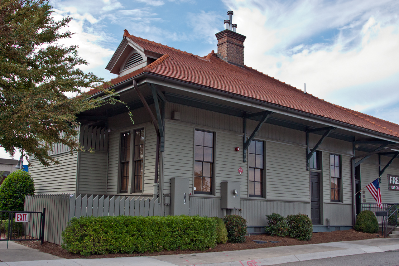
- Woodstock Depot — MrGeode13. Original photograph; CC BY-SA 3.0. Resized for display.
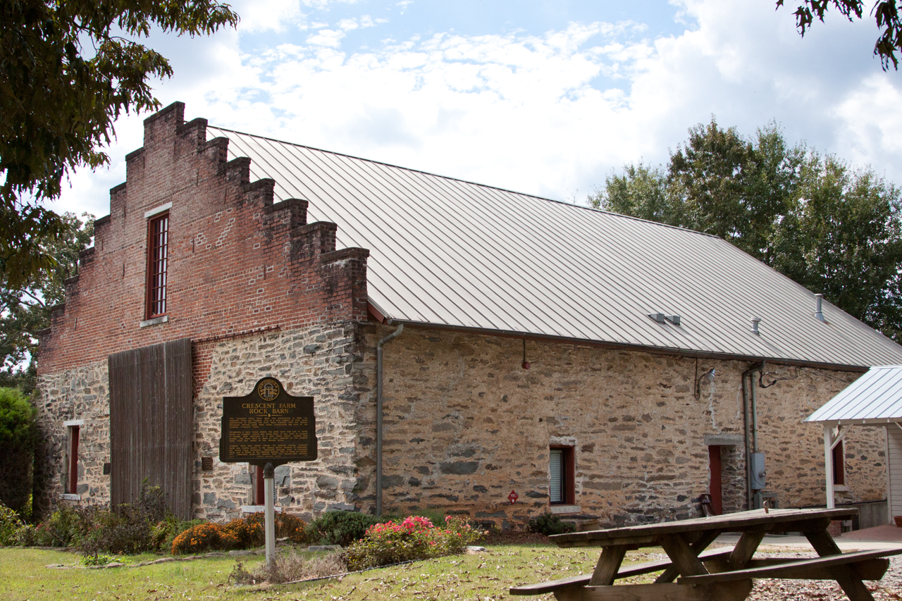
- Crescent Farm Stone Barn — MrGeode13. Original photograph; CC BY-SA 3.0. Resized for display.
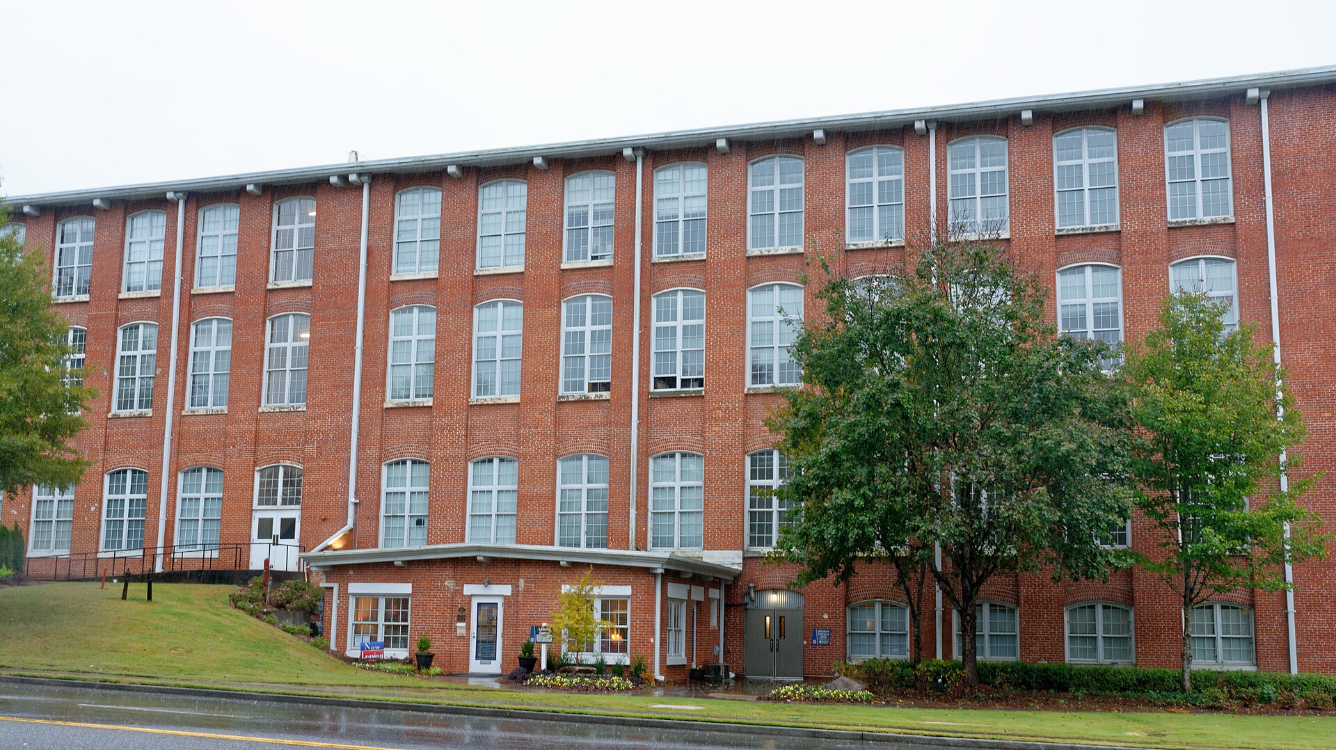
- Canton Cotton Mills No. 2 — Jud McCranue. Original photograph; CC BY-SA 4.0. Resized for display.
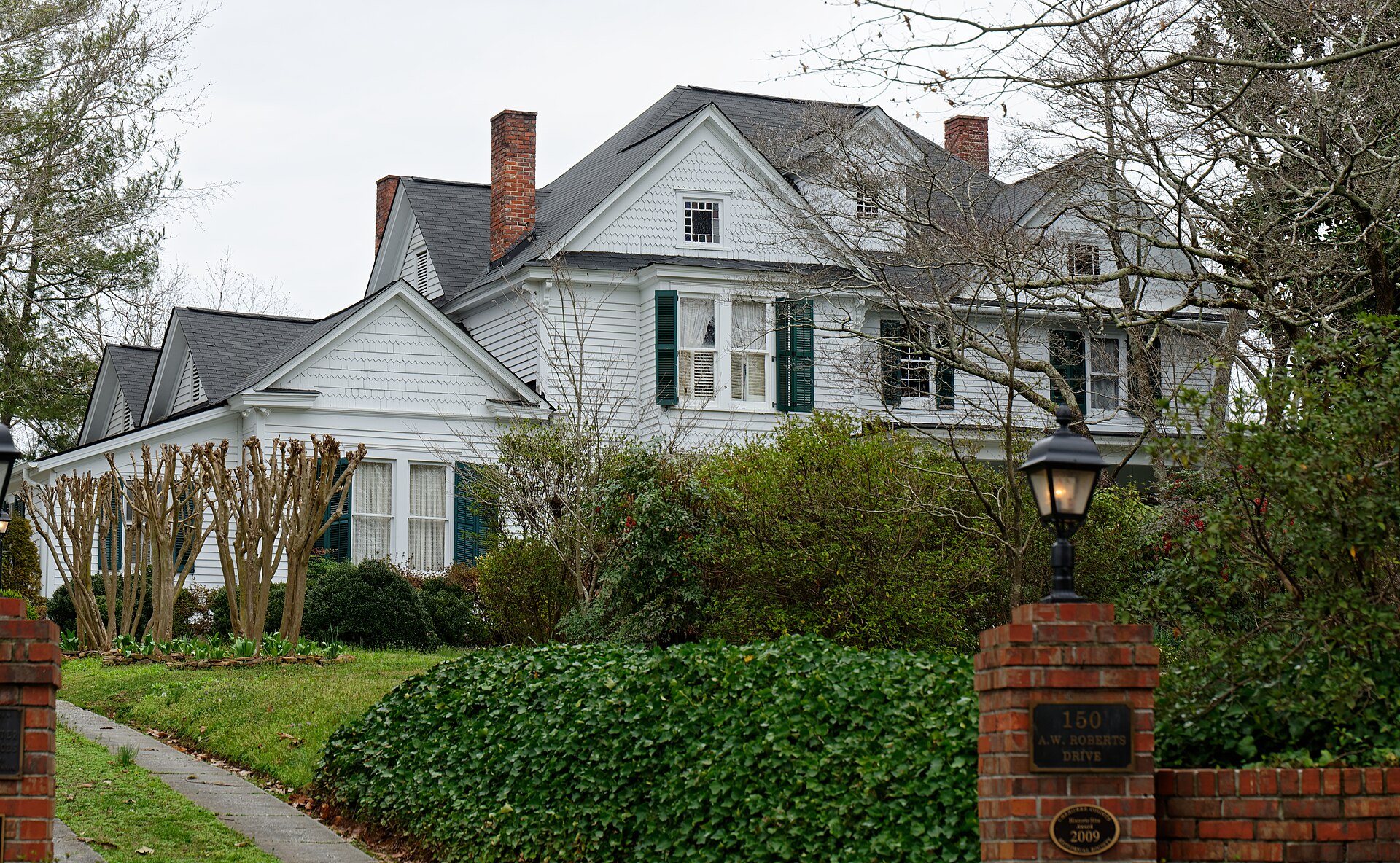
- Alfred Roberts House in Ball Ground — Jud McCranie. Original photograph; CC BY-SA 4.0. Resized for display.


Every place has a story.Find Your Next Favorite.
County Photo Credits
Images are historical views, not live conditions. Display versions may be resized or cropped.
- Pine Log Mountain and Bear Mountain, Cherokee County, Georgia — Thomson200; CC0.
- Old Cherokee County Courthouse; Canton, Georgia; November 4, 2012 — Stephen Matthew Milligan; CC BY-SA 3.0.

